I went on a 15 day trip from Cairns to Cape York this September. I will write about the trip along with the details of the places I visited. I would like to leave as much detailed information as possible and hope that it will be useful for everyone who reads this article when planning a trip to Cape York.
Where is Cape York?
First, where is Cape York? the northernmost tip of the continent in the northeastern part of the Australian continent. And the peninsula sticking out from the northeastern part of the Australian continent is called Cape York Peninsula.
The Cape York Peninsula begins around Cairns on the east coast, so especially for those who come up from the south such as Sydney and Melbourne and head for Cape York, they feel that Cairns is the starting point of the Cape York trip.
As someone from Cairns, do you live on the Cape York Peninsula?
Maps and guidebooks used on the Cape York trip
Here are the maps and guidebooks that were essential when planning and during our Cape York trip.
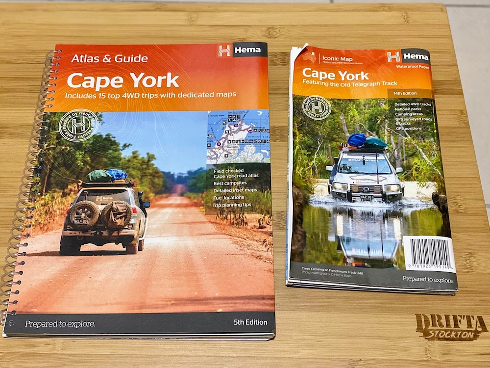
These two books from Hema. On the right is a large, waterproof map made of paper that can get wet, and on the left is the Atlas Guide, which is not only a map, but also a great read.
Before the trip, I read the Atlas Guide when I had time at home and looked through various information. As for the map, I looked at it many times every day, reviewing the plan during the trip and re-planning it again.
In addition, I downloaded an offline map to Google Maps on my iPhone in advance and used it to check my current location while traveling.
Trip Day 1, Cairns to Laura
Well, it’s the first day of the Cape York trip. I had all my luggage in the car by the night before, so I was able to leave without much hesitation in the morning. At 9 o’clock, we will meet in front of the Smithfield shopping center with our friends who will be going with us, and from there we will head north on Route 81 Mulligan Hwy via Kuranda and Mareeba.
And we arrived at Lakeland Roadhouse in the afternoon.
Lakeland
We had a lunch break here. We ate a sandwich that I made in advance, and then refueled. Up to this point, it was 230km from Cairns, and the road was paved all the way, and I only used about 1/4 of the fuel. I think it’s better to fill up frequently.

Coming north from Cairns, there is a roadhouse on the right, but there was a new facility on the left across the road (the last time I went there was about 4 years ago.) There is a big sign “Gateway to Cape York”. There were several picnic tables and a large map of the Cape York Peninsula along with many information boards introducing tourist spots and attractions.
Lakeland is about three hours from Cairns. It’s the perfect place to take a break, have a snack, and gather information. We didn’t stop by, but the Lakeland Caravan Park is just around the corner, so it wouldn’t hurt to stay a night here if you need it.
Well, here in Lakeland is a big fork. If you continue straight on Mulligan Highway, you will reach Cooktown. The highway is paved all the way, so any vehicle can take the Mulligan Highway from Cairns to Cooktown. Next, turn left immediately after exiting the roadhouse and the Peninsula Developmental Road (PDR) starts from here. From here, follow this road all the way north.
After a lunch break, we traveled north on the PDR and arrived at a town called Laura, 80km from Lakeland.
Laura
Laura is 310km from Cairns and the road is paved all the way. We arrived around 3:00 pm, and this is the end of the first day’s travel. Just after passing the roadhouse, there is a bridge over the Laura River.

Laura was much hotter than Cairns. It feels like an inland climate, and when we arrived in the afternoon, it was still over 30 degrees.
Trip Day 2, Laura to Coen
On the morning of the second day, we had breakfast, pack our bags and depart at 8:30, heading further north. The road becomes unpaved just past Laura. There are some paved roads here and there, but I think that the unpaved road continues from Laura onwards.
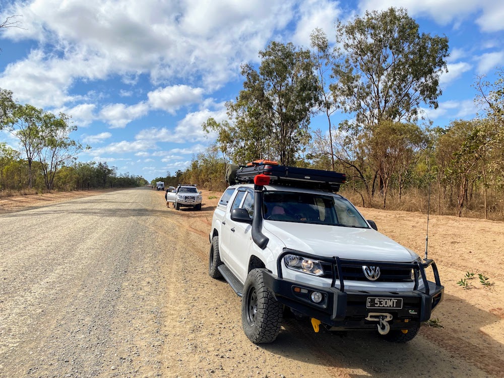
As soon as the road turned to dirt we parked and adjusted the tire pressures to compensate for the dirt road corrugation. Corrugation is a wave-like unevenness that can be created on the road, and the vertical movement of the tire caused by a slight step generates regular pressure on the road, creating unevenness. So, the more cars run on the road, the bigger the bumps become, and the more the road gets damaged. Road trips in Australia have become popular, especially since the COVID-19 pandemic, and more and more people are heading to Cape York.
For my car, I went from 38 psi front and 44 psi on the highway to 26 psi front and 28 psi rear when the dirt road started. This is to soften the shock from unevenness and to prevent further corrugation.
First trip trouble!
Troubles are inevitable on a trip, but trouble occurred immediately on the second day.
On the second day, I left Laura and continued north, but the corrugations on the unpaved road were terrible. . First, turn on the headlights so that the oncoming car can see your car, and turn on the air conditioner to circulate the inside air to prevent dust from entering. In good places you can run at 80km/h, but in bad places you have to slow down to about 30km/h, and you have to avoid places with large grooves called dust holes. I will be driving while checking the visibility in front, the road surface condition, and the presence or absence of oncoming vehicles, much more carefully than usual.
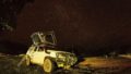
While driving like that, just before I reached Coen, 250km north of Laura, I started to hear an unpleasant sound coming from the roof of the car. Among the rattling sounds that you hear while running on the corrugation road, there is a loud rattling sound that you hear occasionally. This is a sound that I didn’t hear before. I’m curious, so I stop once and check on the roof. There is a roof bar on the roof and a roof top tent is attached on it. There are more bars on top of the rooftop tent, with solar panels and recovery boards attached. I tried shaking everything that was attached, but none seemed to move easily, and the straps held them firmly in place.
For the time being, I drove slowly and carefully, and although I still heard some loud noises, I arrived at Coen safely. We stopped in front of a small petrol station and took a lunch break here. It’s a little bit, but I’m going to refuel and fill up. Then, I suddenly noticed it when I lifted the roof bar that attached the roof top tent. On the left side of the front roof bar, the bolt holding the roof leg and roof bar was missing. So, when I lifted the roof bar, the roof top tent was floating from the roof of the car.

I had spare bolts of the same size, but they weren’t long enough. . So I asked the man at the gas station if there was a longer bolt of the same size. He found it just right from his toolbox. Thanks!
We ate lunch and the kids played in a nearby park.
What I learned from this is to check all bolts, nuts, screws, straps, etc. before a trip. I checked everything on the roof bar, but I forgot to check the roof bar itself. After that, in order to bring a spare bolt, I will bring a grinder along with the main size (M6, M8, M10, M12) as long as possible. That way, if it’s too long, you can cut it and use it.
Well, I planned to go a little further on the second day, but it was almost 3 o’clock when I fixed the roof bar and was able to leave, so I changed my plan and went to Coen on the second day. I decided to go camping. So the second day’s trip is 250km from Laura to Coen.
Coen River Free Camp Area
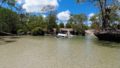
Camping in Coen was the Coen River Free Camp Area. Located along the Coen River, it’s a great place to camp for free wherever you want.

After entering the camp area, there is a place on the side of the river, but we recommend the other side across the river. Then you can take a place right in front of the river, and of course it’s a beautiful river where you can play in the river, so you can jump in and play right away.
After arriving at Coen, I was sweating and working hard to fix the roof bar, so when I arrived at the camp area and parked the car, I jumped into the river, cooled off slowly, set up my tent, ate dinner, and then went into the night. I was able to relax.
Trip Day 3, to Chilli Beach
On the 3rd day of the trip, we packed up our luggage as soon as we had breakfast and left Coen at 8:30. Then about 100km from Coen, turn right onto Portland Road towards Chilli Beach. Portland Road is also a dirt road, with narrow roads, many curves, and many crossings of small creeks. So the running speed will be slower than in PDR. Don’t rush, go slowly and watch out for oncoming traffic.
Mount Tozer lookout
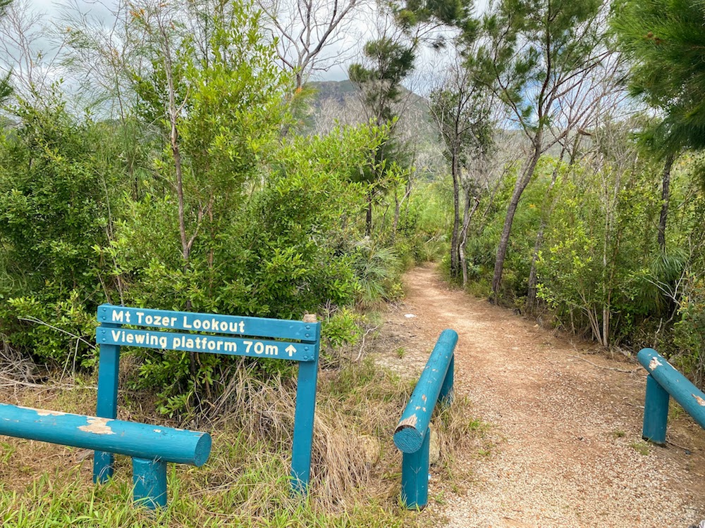
One stop along the way was Mount Tozer Lookout. This is a short walking track just 70m from the parking space, overlooking Mount Tozer, in the Kutini-Payamyu (Iron Ranges) National Park. Let’s take a short break and walk lightly to see it.
Chilli Beach Camping Area

There are two forks along the way, but there are easy-to-understand signs for Chilli Beach, so follow the signs and continue along Portland Road for 120km until you reach the Chilli Beach Camping Area.
The Chilli Beach Camping Area in Kutini-Payamu (Iron Range) National Park has a total of 25 campsites scattered along the beach.

We went with 3 families and reserved 17, 18, 19 with 3 sites next to each other. 2 nights here in Chilli Beach. Campsite reservations can be made online through the Queensland National Parks Reservation Service website.


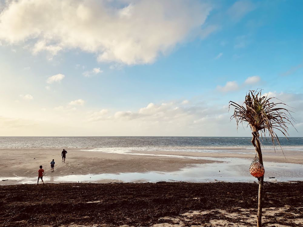
Arrive in the afternoon, park your car at the campsite, and relax. Stroll the beach and grab a bonfire I finally got a bonfire.

It was a bit of a journey to get to Chilli Beach, but we were able to relax during our two night stay here. The children had a great time playing with it.
On the morning of the second day at Chilli Beach, I went fishing with my son as soon as I woke up. How about fishing in a very shallow sea? I thought, but for now my son wants to try it, so I’m going to take a walk in the morning.

It was just a seaweed tangle without any hits, but it was a good exercise before breakfast.

I was curious about the signs “CAFE” and “Best Seafood in the Cape” at the fork in the road when I came, so I went for a little drive in the afternoon and went to see it.
You will come to the end of Portland Road. There is Esplanade, a street along the sea, and I found a cafe in the best location called “Out of the Blue CAFE” in such a place.

Beach right in front of you. Several small boats were parked.

The time is 3:00 pm. It was a perfect afternoon tea time. But business days are Thursday-Sunday, and Monday-Wednesday is closed. And this day was Tuesday. . disappointing. I wish I could have researched it beforehand.

I returned to the Chilli Beach campsite and decided to have dinner by the bonfire. Speaking of grilled meat, I grilled steak using a grill net and ate it.

Day 5 of the trip, leaving Chilli Beach to the next destination
After a leisurely 2 nights camping at Chilli Beach, on the 5th day of the trip, we will leave Chilli Beach and head to our next destination. After returning to Portland Road and exiting the PDR, I headed north again from here.
Continue to No.2 To Old Telegraph Track